SHT: Dyer’s Creek to Britton Peak Flip-Flop Hike
Schroeder, MN
The plans for this girls trip have been in the works for a few months, since Joe was going to be up in Canada fishing with his dad this week. I figured hey, while the husband is away, why not have a girls backpacking weekend? Luckily Laura was on board and before we knew it, July 12th was here! The forecast was looking beautiful for the weekend, and we were excited to get out on the trail - this was Laura’s first SHT experience, and I was looking forward to showing her my favorite place in Minnesota!
Day 1: Cook County 1 to Dyer’s Creek Campsite
Our plan was to take the SHT shuttle from Cook County 1 north to Britton Peak Trailhead on Saturday morning, then hike south back to the car over 1.5 days. Instead of leaving Minneapolis at an unspeakable time Saturday morning or having to get a hotel on the North Shore Friday night, we decided to drive up to Schroeder on Friday and get on the SHT at a spot where we would only have to hike a mile or so to a campsite. Just as it happens, this was possible at Cook County 1, where we planned to leave our car overnight on Saturday! We made a plan to park the car at the trailhead on Friday, hike a mile south to Dyer’s Creek Campsite, then in the morning hike back out to the car and catch the shuttle northbound. This way we could cover the trail from Dyer’s Creek to Britton Peak using a flip-flop method. It was a solid plan, what could go wrong?
Traffic up to the shore was an extra special treat (eye roll), and after a couple of stops for dinner and to pick up some necessities, we were in Schroeder. We estimated we would be on the trail sometime around 8:30, and were confident we could make it to camp by 9, with just enough time to set up before dark. We turned off Highway 61 onto Cramer Road, following the instructions to the trailhead to a T. The only issue was, for the life of us we could NOT find the trailhead. We knew it was supposed to be ~ 3.5 miles from the highway, but we drove up and down Cramer Road for at least an hour looking, stopping at multiple turn-outs thinking “This one has to be it”…but we were sadly mistaken. Eventually I was able to spot a trail marker from where the trail crossed the road, and we knew the trailhead had to be close. It turns out we had driven right past the sign for the SHT parking by mistake, and we didn’t end up finding it until about 9:30. This is the part where I defend our honor- to be fair, the sign was a little obscured by some shrubs, the writing was faded from the direction we came in, it was dusk, and we may have been jamming out to Backstreet Boys at the time…now let’s move on.
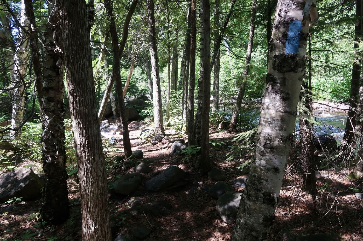
We parked the car, strapped on our packs, covered ourselves in bug spray, and put on our headlamps. It was about 9:45 when we set out on the trail, and we made great time to the campsite. Our headlamps did a pretty good job of leading the way, and I’m proud to say neither of us took a tumble over the many rocks and roots along the dark trail. We hiked past the sound of a nearby creek, and we knew we were getting close to Dyer’s Creek Campsite, our destination for the night. Just when we started questioning if we had passed it, there it was, and we hiked in around 10:15. We crept along the trail to the campsite, just in case we had any neighbors who might already be sleeping. There was a tent and a hammock in the campsite, and luckily there was lots of room for another tent. We put our stuff down and started assembling the tent, and our neighbor in the hammock asked if we were OK, which was really nice of him! We eventually got the tent set up (after a little oopsie where we mixed up the rain fly and the actual tent - it was new!), we hung up our bear bag, and snuggled into our sleeping bags. We left the rain fly off the tent for the sake of getting to sleep, and it was beautiful to look up at the starry sky, the moon, and lightning bugs zipping around our tent.
Here’s a picture of our hike in:
Hahahahaha! Just kidding.
Day 2: Dyer’s Creek to Cook County 1, Britton Peak to Ledge Campsite
We woke up early the next morning and started packing up camp and making breakfast. Our neighbors got up after we did, and we apologized for the late-night entrance. Turns out they had just gone to bed about 20 minutes before we got in, so they weren’t asleep yet, and they were just glad we were okay. Our camp-mates consisted of a solo hiker from Minneapolis, and a married couple that came all the way from New Zealand to hike the SHT! We visited with them for a while that morning, talked about all of our hiking plans for the weekend, and eventually they took off to continue their longer treks. We had plenty of time to hike back to the car and catch the shuttle, so we really took our time packing up and relaxed a bit. We hiked the mile back to our car and got on the shuttle, which dropped us off at Britton Peak Trailhead. We hopped on the trail and got to work!

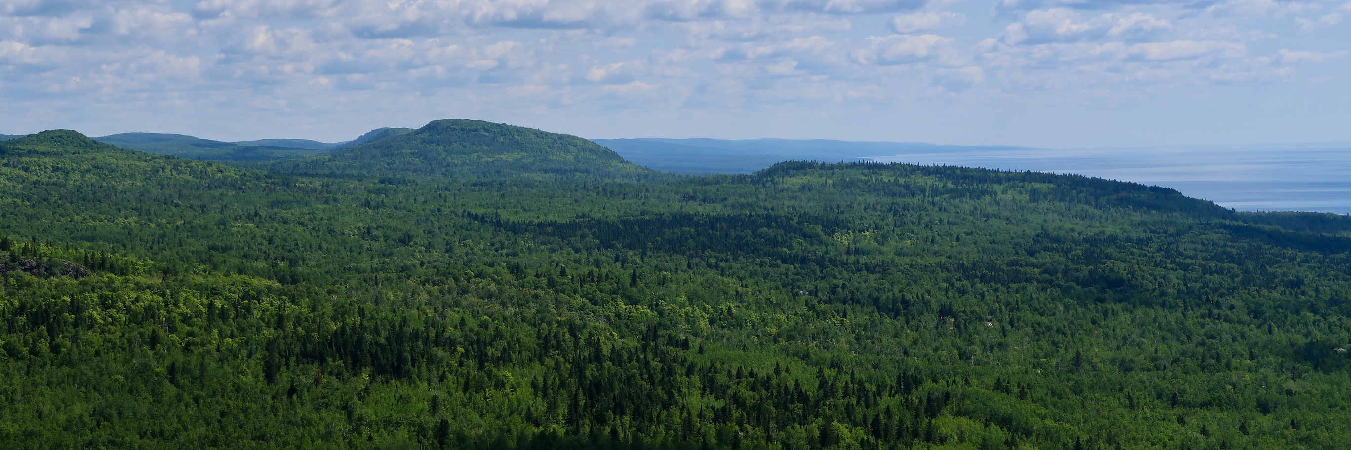
The trail took us through a dense green forest with a little bit of up and down (good old SHT), some rocky areas, and then we took a spur trail up to Ted Tofte Overlook. From the top, we had beautiful views of Lake Superior, inland ridges, a sea of pines, and outlines of the Sawtooth Mountains off to the north. We took the opportunity to take off our packs, have some snacks, and rest a little while. The views from the top made us sluggish to leave, but we picked up our packs and headed toward the main SHT.

We passed a trail register and flipped through the pages. It was fun to read other hikers’ entries, and we added one of our own. We continued down the trail, and realized a little too late that we accidentally passed the spur to Carlton Peak (second time we got lost so far this trip haha). We decided to turn back because we wanted to see the overlook, and we climbed back up a steep section that we had just descended (facepalm). This was a beautiful section with large rocks and cliffs, and eventually we made it to Carlton Peak - another rocky outcrop with nice views of the lake and more bright green pines.

We stopped at a third spur to another overlook and on our way back, accidentally got on the SHT headed the wrong direction - we realized it after a few minutes, and passed some trail runners who confirmed our suspicions that we were in fact turned around. (SHT: 3 – Laura and Ashley: 0). We continued on, and the trail took us through Temperance River State Park. We passed by the river surrounded by a beautiful gorge, rapids, and small waterfalls. We came across a big open area on the river with another gorge - we rested here for a while and watched some people jump off the side into the river, got to pet some nice dogs, and we wished we packed swimsuits!

After the trail left this section it got really hot, STEEP, and the thick vegetation seemed to be closing in around us. This was a really tough part of the trail, and the incline went on forever! Finally it leveled out, then descended down to the Cross River. It had cooled off a little by this point in our day, and the trail followed the river which provided a nice breeze and some shade, and it felt wonderful! We passed by two awesome campsites right on the river (North and South Cross Campsites) but we kept going because we wanted to make it a few more miles before settling down for the night. We kept following the river, and eventually got to Ledge Campsite, where we decided to call it a day.
It had been a long day for us, with the one mile hike to the car from Dyer’s Creek, plus the trail mileage of 8.2 miles from Britton Peak to our campsite, plus the extra mileage from when we got turned around (twice). We figured we put in at least 10 miles, and according to my watch about 1,700 feet of elevation gain. We set up camp and then went down to the river to filter some more water and cool ourselves off, which let me tell you, felt great after a long day! We attempted a fire, and I got to test out our new backpacking saw to cut up some downed wood, but unfortunately no such luck. I’m not sure what it is about not being able to make a fire on the SHT…I’m blaming this one on wet wood! On a side note, the saw did great! We made dinner and relaxed around the campsite for a while, then turned in early - we were exhausted and we wanted to get an early start in the morning. It was so nice to relax in our comfy sleeping bags listening to the sounds of the river as we fell asleep.

Day 3: Ledge Campsite to Cook County 1
We woke up early on Sunday and I got started on filtering water and making breakfast while Laura packed up the tent. It was a nice morning - a little bit cool and the sun was shining through the thick tree cover above us. We were both feeling a little sore and tired from our hike the day before. It’s amazing how being on the trail all day sometimes has this tendency to completely drain you of energy and make you curse yourself for picking such a long route…but then you wake up the next morning and breathe the fresh air, look around your incredible campsite, and think hey, this is pretty great - I’m pumped to do this again today.

We were headed out of camp before 8 o’clock, and followed the trail along the river and over a series of cool (albeit unsteady) boardwalks. We passed through Boney’s Meadow and saw several moose tracks! This was a special treat for me as I had never seen them before in Minnesota. It got pretty buggy in this section, and we broke out the head nets to protect our poor faces! They worked remarkably well (except that Laura didn’t have a hat, and a fly bit her through the net on her forehead). The trail took us through a rocky open area with lots of Ox-eye Daisies, then passed by Tower Overlook, which gave us pretty views of Lake Superior the same color as the sky. We were back at the car by 10am, after a 4.6 mile hike, and treated ourselves to coffee and pastries at a local shop. We pulled over a few times to admire the Lupines that were in full bloom along the side of Highway 61 - gorgeous seas of light and dark purple, with the occasional pink and white bursts! We had originally planned to stop at the lighthouse at Split Rock, but opted out in the interest of making it home at a decent time (and also didn’t want to pay the fee). We jammed out to Disney songs and reminisced about our weekend on our way back to Minneapolis.

We had a little bit of a rocky start, and got turned around more than we would have liked, but it was a great weekend through a beautiful section of trail with good company. Lots of lessons were learned, but I wouldn’t trade my experiences on the SHT for anything, especially experiences with good friends!
Until next time, North Shore!

Sources: Guide to the Superior Hiking Trail, Eighth Edition. Compiled by the Superior Hiking Trail Association.